Category: News

Flood Surveys

Surveys Made Easier with the Most Advanced UAV Service in Ontario

Are you looking for ways to make aerial surveys easier? If you’re interested in high quality insurance surveys and aerial flood survey services, look no further than UAV Ontario – the most advanced and impressive drone video service in this part of Canada.

Flood Surveys
Flood Surveys
Flood Surveys

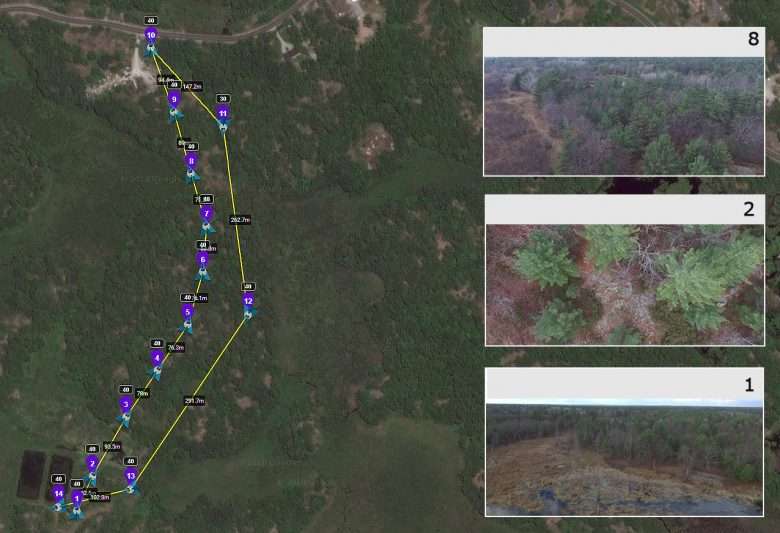
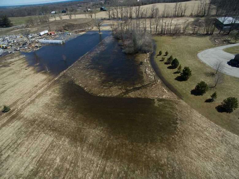
Whether you want aerial photographs for a drainage survey, or you are tasked to get details of how the terrain shifted after a large flood, aerial photography and video services are the best answer. UAV Ontario has advanced drone technology and the ability to produce high resolution pictures and videos for city plans, construction reports and a variety of other application. If you want your survey to go well, all you have to do is call on them, and they will complete the hardest part of the work in record time.

Georeferenced Land Survey

Georeferenced Land Survey – Versatility and Efficiency with Advanced Photography and Videography

The state-of-the-art georeferenced land survey services offered by UAV Ontario use the most modern unmanned air vehicles, also known as drones, for creating complex, sharp and accurate images of various environments. Whether you are looking for commercial or agricultural surveys, for pipeline or powerline surveys or surveys performed of areas that are difficult or dangerous to access for humans, the experienced and certified drone pilot assigned to your project will use the latest technology as well as his wide knowledge of aviation techniques and of aerial photography to create the type of images and videos that best suit your goals. The company’s fleet of drones includes rotary wing as well as fixed wing units, allowing clients to choose the best fit.

SFOC

Legal Drone Photography

A Special Flight Operations Certificate (SFOC) provides an approval to operate unmanned air vehicle (UAV) (non-recreational drone) and tells you how and where you may fly.

If you are flying for anything other than for fun, we consider that you are flying for work or research and that you are flying a UAV (non-recreational drone). Examples of the type of work that may be conducted using a UAV include, but are not limited to:

  • survey,
  • agricultural,
  • inspections,
  • academic research,
  • first responders, and
  • aerial photography and videography (including for real estate).

Flying a UAV for payment or any other benefit or gain is also considered flying for work/non-recreational purposed.

To use a UAV for any kind of work or research, you must in most cases hold an SFOC. This applies to all UAVs no matter how much they weigh. The only exception to the requirement for an SFOC is if you intend to operate a UAV under one of the Transport Canada UAV exemptions.

aerial-drone-photography

With our combined experience, licenses and insurance we are now able to provide legal UAV work throughout Ontario.

Please contact us to survey and apply for your next aerial photography or videography project.